All Photos
Mersin Port
36°33'48.00"N 29°5'23.00"E
313-236 B.Adm.
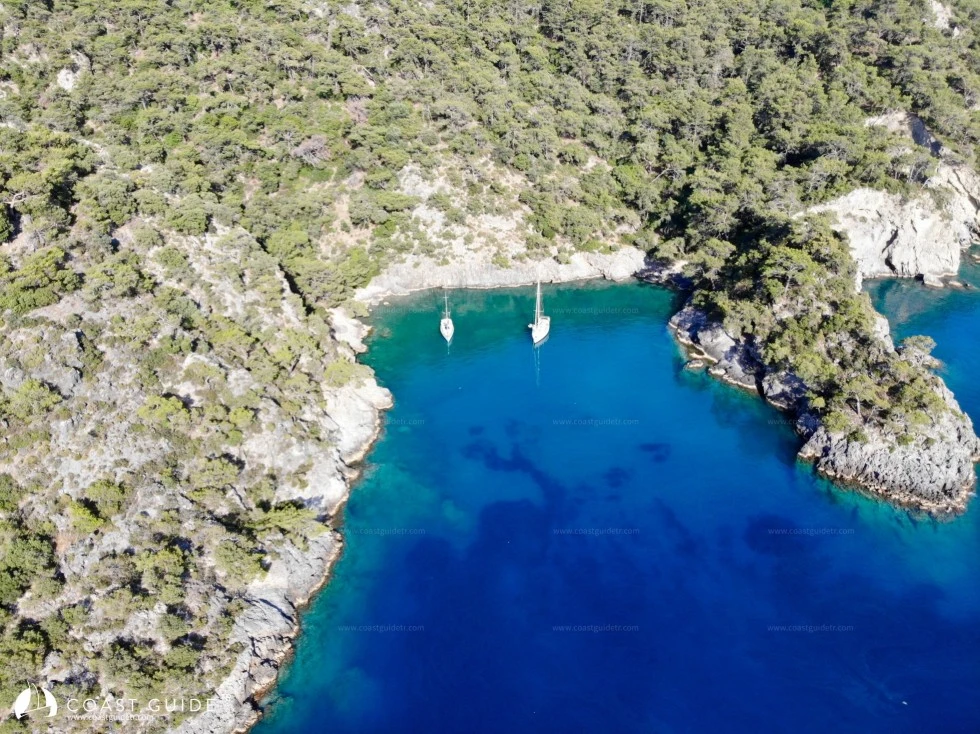
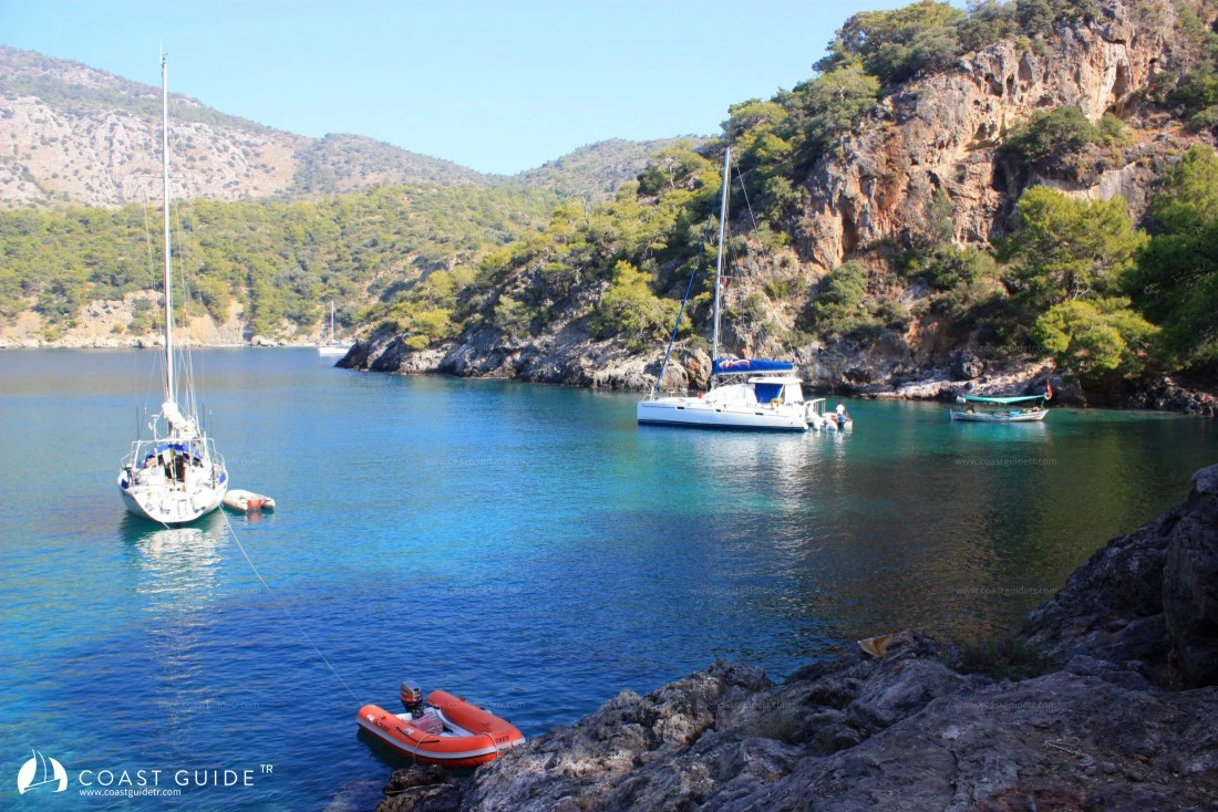
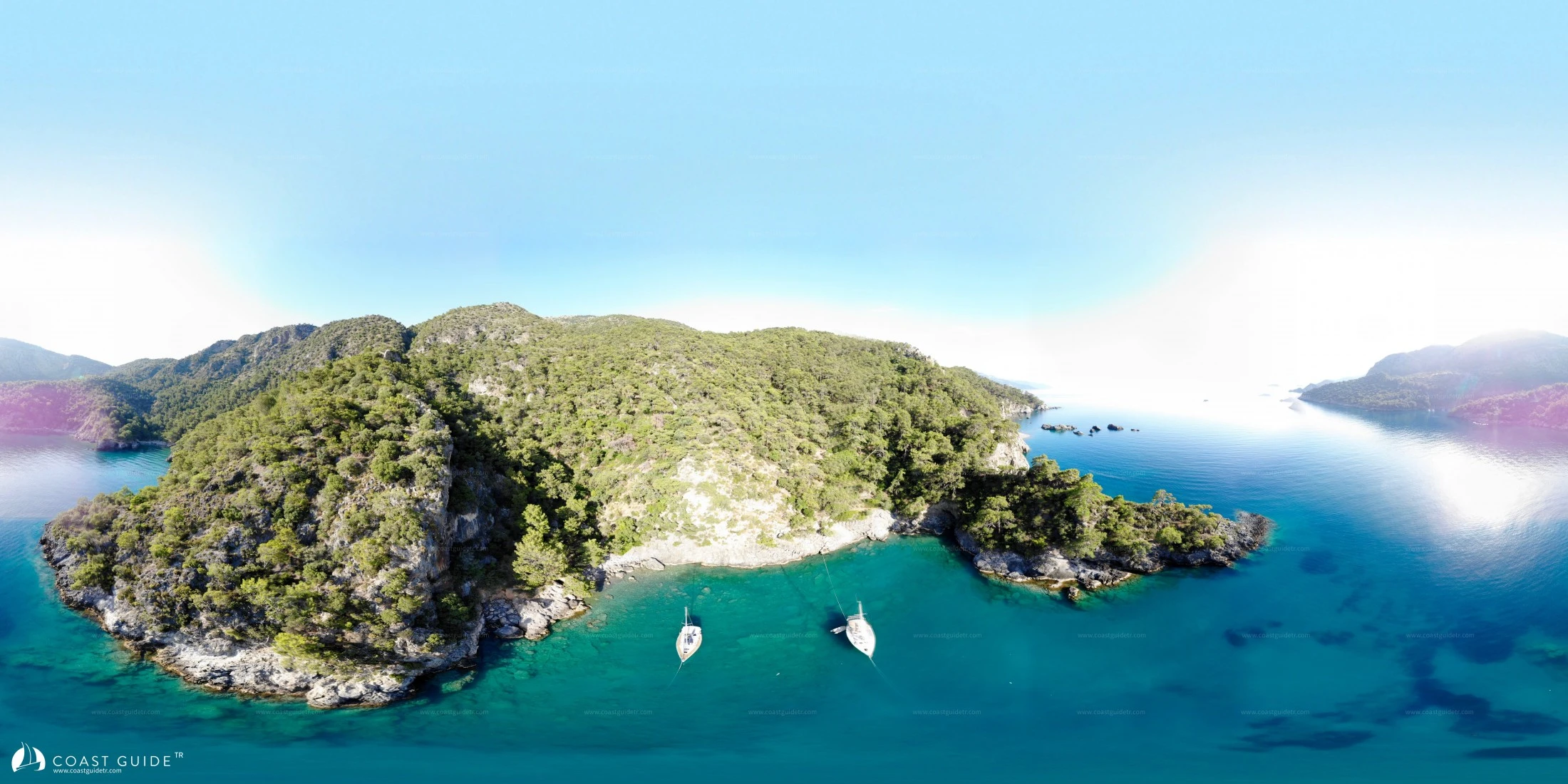
Bektaş Bay, which extends northward at the northeast of Gemiler Island, has two bays at its end, curving to the east and
west.
SOĞUKSU PORT
36°33'47"N - 29°04'58"E
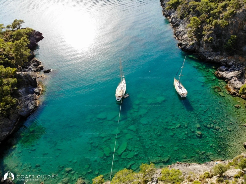
At the end of Bektaş Bay, extending with a curve to the west, is Soğuksu Port. The bay is deep inside.
On the southern shore of the bay there is a small cove where only one or two vessels can shelter. To the west of this cove, among the rocks, there is a freshwater spring. The bay, surrounded by pine trees, takes its name from this water.
At the end of the bay there is a small but very beautiful beach. Vessels anchor between 6-8 meters and take lines from the beach or shores. It is a very small, charming but crowded bay.
It is said that the bay was once the pier of the historical Kaya Village. A footpath leads from the shore to the village. Just above the beach, at a point overlooking the sea, there is a dome.
The bay is one of the stopping points for tour boats during daytime hours and becomes crowded.
If one wishes to stay peacefully in this excellent bay, it is advisable to avoid the hours between 10:30-17:00.
The bay is not sheltered in southerly winds.
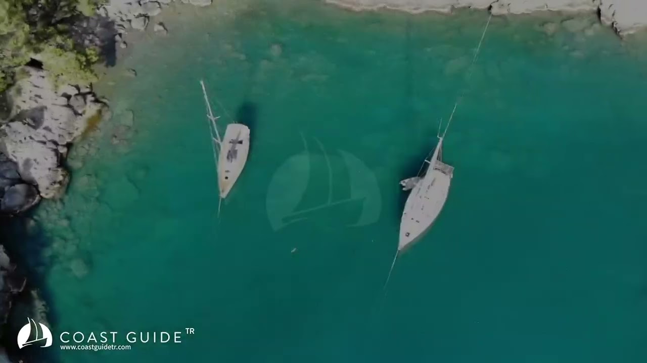
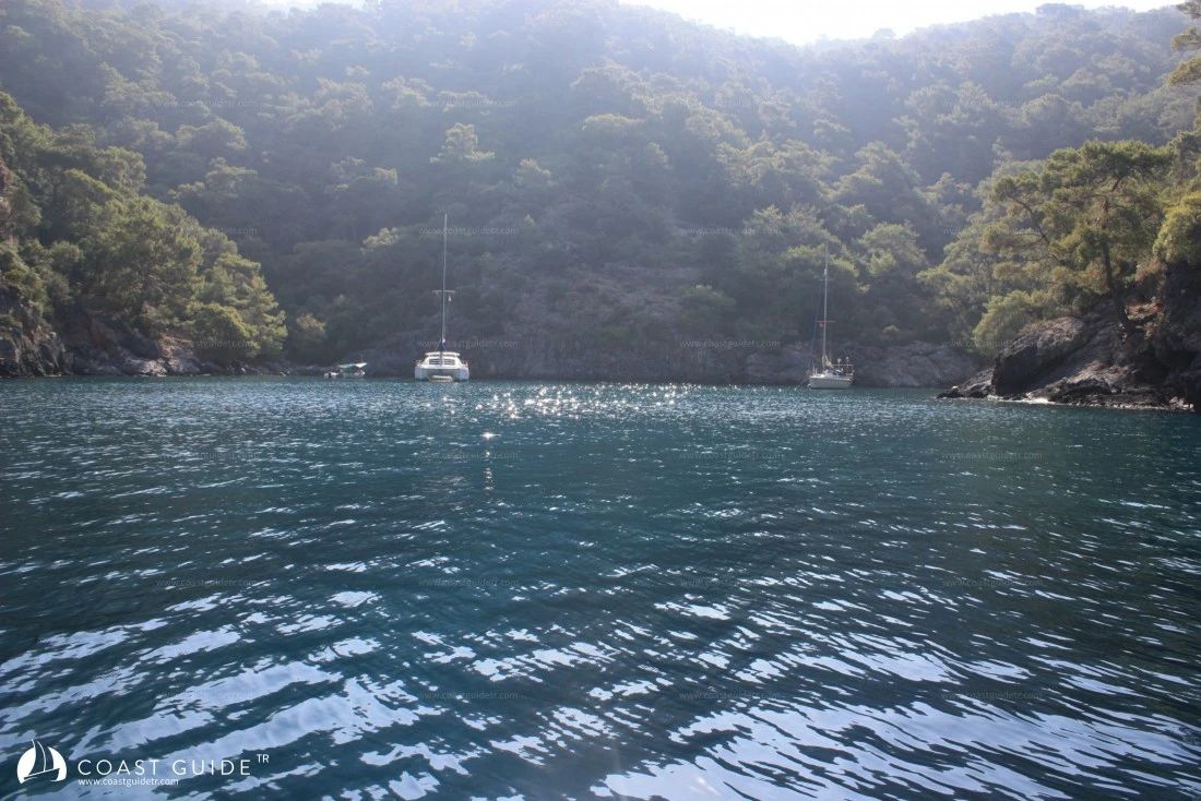
MERSİN PORT
36°33'48"N - 29°05'23"E
At the end of Bektaş Bay, the eastern cove is Mersin Port. The bay is deep inside.
It is surrounded by steep rocks and pine trees. Compared to Soğuksu Port, it is smaller but more peaceful and sheltered.
Anchor between 6-9 meters on sandy bottom and take lines from shore. However, there is debris close to shore.
It receives light breeze.
It is a very special bay, a different mooring point among high mountains.
Pristine, there is no road connection.
Marine Chart
Initializing...
Weather
00:00 19°C
19°C
PRESS
1011
HUM
74%
2.7knots
N03:0018°C
PRESS
1011
HUM
73%
2.7knots
NNE06:00 18°C
18°C
PRESS
1011
HUM
75%
2.7knots
N09:0023°C
PRESS
1012
HUM
56%
2.7knots
NW12:0026°C
PRESS
1012
HUM
52%
5.4knots
W15:00 27°C
27°C
PRESS
1012
HUM
54%
5.9knots
WSW18:0026°C
PRESS
1011
HUM
57%
5.9knots
WSW21:0023°C
PRESS
1012
HUM
64%
2.7knots
N00:0021°C
PRESS
1013
HUM
63%
3.2knots
NNE03:0020°C
PRESS
1012
HUM
58%
4.3knots
NE06:0019°C
PRESS
1012
HUM
61%
4.3knots
ENE09:0025°C
PRESS
1013
HUM
45%
1.6knots
N12:0026°C
PRESS
1014
HUM
46%
5.9knots
SSW15:0026°C
PRESS
1014
HUM
49%
5.9knots
SSW18:0025°C
PRESS
1013
HUM
52%
3.2knots
SSW21:0021°C
PRESS
1013
HUM
65%
1.6knots
E00:0019°C
PRESS
1013
HUM
71%
1.6knots
NE03:0018°C
PRESS
1013
HUM
71%
1.6knots
NE06:0017°C
PRESS
1013
HUM
73%
1.6knots
ENE09:0023°C
PRESS
1014
HUM
55%
1.6knots
SW12:0025°C
PRESS
1014
HUM
53%
5.4knots
SW15:0026°C
PRESS
1014
HUM
55%
5.4knots
SW18:0025°C
PRESS
1014
HUM
57%
3.2knots
SW21:0021°C
PRESS
1014
HUM
71%
1.1knots
EVideo