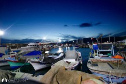
Çandarlı Limanı lies on the northern side of Çandarlı Bay. Eşek Adası (Islet) is on the east part of Değirman Adası Point. The entrance is from the western side. The area between the islets and the mainland provides all round shelter except southerlies, and it ends a nice sandy beach. The eastern side provides adequate shelter. Depths gradually shelve ashore. The bottom is muddy, providing good holding in depths of 4 – 8 meters. Strong northerlies are dominant but, it does not build choppy seas. Sea water temperature is lower but, it has cool effect in hot summers. The pier on the west has limited space for the visiting yachts. Boats drop anchor and go to stern if there is room. There are private laid moorings lines around the jetty. The town center is behind the port. There is a small shelter for the fishing boats nearby the castle. This castle was built in 14th century.
All kinds of provisions can be found. Some mechanical and electrical works can be carried out from town industrial zone. Public market is on Fridays. Transport services are available to most destinations, regular buses run to İzmir and Dikili. The older part of Çandarlı stretches along the peninsula; teahouses and restaurants are the big attractions for the visitors. You can find nice spots to stroll around.


